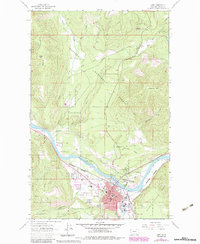
1963 Map of Libby
USGS Topo · Published 1984About this map
The Kootenai River defines the heart of this region, serving as the topographical and economic corridor for Libby and its surrounding timberlands. As seen in this early 1960s survey with late-20th-century photorevisions, the town center is well-established with essential civic landmarks including Asa Wood Jr HS, Libby High Sch, and the Plummer Sch. The industrial and transport importance of the valley is highlighted by the Burlington Northern railroad line tracking the riverbank, connecting local resources to broader markets. Beyond the residential core and the St Anthony Mission, the map reveals the transition into the Kootenai National Forest, where topography rises sharply toward Lindy Peak and Sheldon Mtn. Notable recreation and local culture points are visible at Timberlane Campground and a Drive-in Theater, providing a detailed look at the infrastructure of a mid-century Montana mountain community.
Find a feature on this map
40 named features on this map. Tap any name to fly to it.
Don’t see what you’re looking for? This feature index may not catch every label — zoom into the map to look around manually.
Map Details
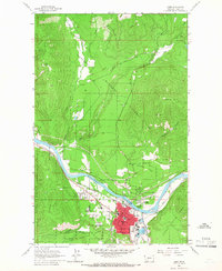
Editions of this 1963 Libby Map
2 editions found
Other maps of this area

1920 · Libby
USGS Topo · 1:125,000

1920 · Jennings
USGS Topo · 1:125,000

1930 · Libby
USGS Topo · 1:125,000

1932 · Libby
USGS Topo · 1:125,000

1935 · Thompson Lakes
USGS Topo · 1:96,000

1942 · Thompson Lakes
USGS Topo · 1:125,000

1957 · Kalispell
USGS Topo · 1:250,000

1960 · Kalispell
USGS Topo · 1:250,000

1961 · Kalispell
USGS Topo · 1:250,000

1963 · Scenery Mountain
USGS Topo · 1:24,000