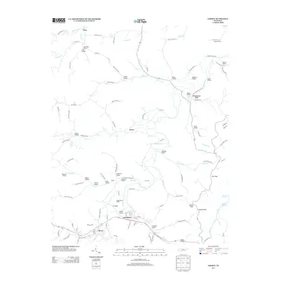
2013 Map of Liberty
USGS Topo · Published 2013About this map
Liberty and Dowelltown anchor the southern corridor of this landscape along the banks of Smith Fork Cr, where the valley floor transitions into a complex network of named hollows and ridges. This 2013 survey illustrates a rural Tennessee environment where small communities like Helton and Temperance Hall remain connected by winding routes such as The Narrow Way and Old Temperance Hall Rd. The terrain is defined by its social geography, with numerous family-named landmarks including Kyle Hollow, Bates Hollow, and Robinson Hollow reflecting generations of local land use.
Find a feature on this map
119 named features on this map. Tap any name to fly to it.
Don’t see what you’re looking for? This feature index may not catch every label — zoom into the map to look around manually.
Map Details
Editions of this 2013 Liberty Map
This is the sole edition of this map. No revisions or reprints were ever made.
Other maps of this area

1893 · Mc Minnville
USGS Topo · 1:125,000

1895 · Mc Minnville
USGS Topo · 1:125,000

1908 · Woodbury
USGS Topo · 1:62,500

1928 · Gordonsville
USGS Topo · 1:62,500

1942 · Statesville
USGS Topo · 1:100,000

1953 · Chattanooga
USGS Topo · 1:250,000

1956 · Columbia
USGS Topo · 1:250,000

1956 · Corbin
USGS Topo · 1:250,000

1956 · Nashville
USGS Topo · 1:250,000

1957 · Chattanooga
USGS Topo · 1:250,000