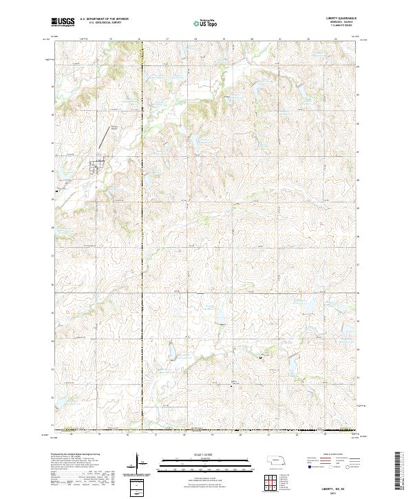
2021 Map of Liberty
USGS Topo · Published 2021About this map
Liberty sits at the heart of this landscape along the border of Nebraska and Kansas, characterized by an extensive system of water management and agricultural landmarks. The terrain is defined by the winding paths of Plum Cr, Mission Cr, and Arkeketa Cr, which are dotted with dozens of specific reservoirs such as Bodie Reservoir and various numbered sites like Plum Cr Reservoir 3-A. This density of flood control structures suggests a high degree of local land engineering to support the surrounding plains. Genealogists and local historians can locate several rural burial grounds, including Liberty Cem, Tanner Cem, and Mission Creek Cem, while Thomas Airport stands out as a distinct private airstrip north of the town center. The map also delineates the precise boundary at State Line Rd, where Gage and Pawnee Counties in Nebraska meet Marshall County in Kansas.
Find a feature on this map
74 named features on this map. Tap any name to fly to it.
Don’t see what you’re looking for? This feature index may not catch every label — zoom into the map to look around manually.
Map Details
Editions of this 2021 Liberty Map
This is the sole edition of this map. No revisions or reprints were ever made.
Other maps of this area

1889 · Seneca
USGS Topo · 1:125,000

1889 · Marysville
USGS Topo · 1:125,000

1894 · Seneca
USGS Topo · 1:125,000

1894 · Marysville
USGS Topo · 1:125,000

1955 · Manhattan
USGS Topo · 1:250,000

1955 · Lincoln
USGS Topo · 1:250,000

1956 · Manhattan
USGS Topo · 1:250,000

1957 · Manhattan
USGS Topo · 1:250,000

1957 · Lincoln
USGS Topo · 1:250,000

1958 · Lincoln
USGS Topo · 1:250,000