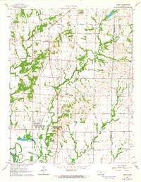
1962 Map of Liberty
USGS Topo · Published 1964About this map
The Atchison Topeka and Santa Fe railroad serves as a central spine through this Southeast Kansas landscape, passing directly through the town of Liberty. This early 1960s survey documents a rural economy still shaped by the Old Indian Treaty Boundary that cuts North-South across the terrain. To the east, the landscape is punctuated by numerous Oil Wells, a Shale Pit, and a Gravel Pit, indicating active extraction industries alongside established agriculture. Local heritage is preserved through dispersed landmarks like Billings Sch and several burial grounds, including Harmony Cem and Centennial Cem. The waterways of Drum Creek and Big Hill Creek wind toward the Verdigris River in the southwest, while Liberty Lakes provide a distinct recreational feature near the town site.
Find a feature on this map
23 named features on this map. Tap any name to fly to it.
Don’t see what you’re looking for? This feature index may not catch every label — zoom into the map to look around manually.
Map Details
Editions of this 1962 Liberty Map
2 editions found
Other maps of this area

1886 · Independence
USGS Topo · 1:125,000

1886 · Parsons
USGS Topo · 1:125,000

1893 · Parsons
USGS Topo · 1:125,000

1894 · Independence
USGS Topo · 1:125,000

1905 · Independence
USGS Topo · 1:125,000

1945 · Parsons
USGS Topo · 1:62,500

1946 · Parsons
USGS Topo · 1:62,500

1946 · Mound Valley
USGS Topo · 1:62,500

1947 · Parsons
USGS Topo · 1:62,500

1947 · Joplin
USGS Topo · 1:250,000