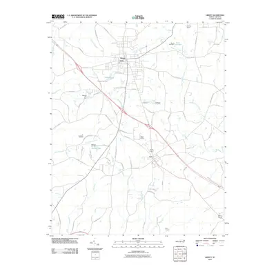
2010 Map of Liberty
USGS Topo · Published 2010About this map
Liberty and Staley anchor this portion of Randolph County, where the landscape is defined by the headwaters of the Rocky River and its various prongs. The 2010 topography reveals a region balanced between small-town centers and rural agriculture, marked by numerous small impoundments such as Patterson Lake, Sizemore Lake, and Wayne Isley Lake. For genealogists and local historians, the map is a primary resource for locating family burial grounds, including Fairview Cemetery, Old McMasters Cemetery, and Olivers Chapel Cemetery, which are distributed along the winding country roads.
Find a feature on this map
86 named features on this map. Tap any name to fly to it.
Don’t see what you’re looking for? This feature index may not catch every label — zoom into the map to look around manually.
Map Details
Editions of this 2010 Liberty Map
This is the sole edition of this map. No revisions or reprints were ever made.
Other maps of this area

1953 · Raleigh
USGS Topo · 1:250,000

1954 · Raleigh
USGS Topo · 1:250,000

1968 · Ramseur
USGS Topo · 1:24,000

1968 · Coleridge
USGS Topo · 1:24,000

1969 · Siler City
USGS Topo · 1:24,000

1970 · Kimesville
USGS Topo · 1:24,000
1970 · Climax
USGS Topo · 1:24,000

1974 · Crutchfield Crossroads
USGS Topo · 1:24,000
1974 · Grays Chapel
USGS Topo · 1:24,000
1974 · Liberty
USGS Topo · 1:24,000