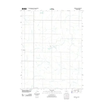
2011 Map of Liberty SE
USGS Topo · Published 2011About this map
State Line Rd defines the boundary between Nebraska and Kansas in this 2011 survey of Marshall County. The landscape is dominated by a dense network of tributaries, including Plum Creek, Wildcat Creek, and West Branch Turkey Creek, which carve through the agricultural terrain. Near the southern border, the Summerfield Cemetery serves as a significant local landmark for genealogical research. Further north, the settlement of Bookwalter sits near the western edge of the sheet, while Plum Creek Reservoir 6-A marks the northern reaches. The map illustrates a contemporary rural environment where the hydrology, from Mission Creek to Robidoux Creek, continues to dictate the layout of roads and land use along the interstate border.
Find a feature on this map
13 named features on this map. Tap any name to fly to it.
Don’t see what you’re looking for? This feature index may not catch every label — zoom into the map to look around manually.
Map Details
Editions of this 2011 Liberty SE Map
This is the sole edition of this map. No revisions or reprints were ever made.
Other maps of this area

1889 · Seneca
USGS Topo · 1:125,000

1894 · Seneca
USGS Topo · 1:125,000

1955 · Manhattan
USGS Topo · 1:250,000

1955 · Lincoln
USGS Topo · 1:250,000

1956 · Manhattan
USGS Topo · 1:250,000

1957 · Manhattan
USGS Topo · 1:250,000

1957 · Lincoln
USGS Topo · 1:250,000

1958 · Lincoln
USGS Topo · 1:250,000

1965 · Pawnee City
USGS Topo · 1:24,000

1965 · Burchard
USGS Topo · 1:24,000