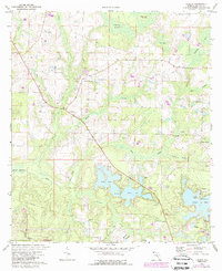
1973 Map of Liberty
USGS Topo · Published 1988About this map
The Liberty settlement and its surrounding wetlands define this portion of Walton County, surveyed in the early 1970s with updates into the mid-1980s. A network of freshwater lakes, including Kings Lake, Holly Lake, and Juniper Lake, dominates the southern landscape, while the northern reaches are characterized by specialized drainage patterns such as Cypress Drains and Bear Pen Island. The map records a rural economy shifting between traditional land use and military expansion, with Eglin Air Force Base bordering the southwestern corner. Genealogy and local history researchers will find the precise locations of the Piney Grove church and its associated cemetery, along with the small community at Cluster Springs. The terrain is marked by numerous industrial sandpits and a complex system of pipelines that cut across the local hydrology near Bell Bay Branch and Nowling Spring.
Find a feature on this map
35 named features on this map. Tap any name to fly to it.
Don’t see what you’re looking for? This feature index may not catch every label — zoom into the map to look around manually.
Map Details
Editions of this 1973 Liberty Map
2 editions found
Other maps of this area

1934 · Niceville
USGS Topo · 1:48,000

1935 · De Funiak Springs
USGS Topo · 1:48,000

1936 · Niceville
USGS Topo · 1:62,500

1938 · De Funiak Springs
USGS Topo · 1:62,500

1949 · Glendale
USGS Topo · 1:62,500

1949 · Laurel Hill
USGS Topo · 1:62,500

1950 · Laurel Hill
USGS Topo · 1:62,500

1951 · Glendale
USGS Topo · 1:62,500

1956 · Niceville
USGS Topo · 1:62,500

1957 · Pensacola
USGS Topo · 1:250,000