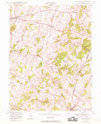
1944 Map of Libertytown
USGS Topo · Published 1970About this map
Libertytown and its surrounding agricultural landscape are defined by the rolling contours of Central Maryland at the height of World War II. This 1944 survey illustrates a network of rural hamlets connected by winding country roads, stretching from Oldfield in the north to the industrial corridor at Mount Airy in the south. The landscape is deeply carved by water, with Linganore Creek and its various forks, including the South Fork and North Fork, creating a complex drainage system that dictated the placement of early settlements and local industries like the Lime Mill.
Find a feature on this map
25 named features on this map. Tap any name to fly to it.
Don’t see what you’re looking for? This feature index may not catch every label — zoom into the map to look around manually.
Map Details
Editions of this 1944 Libertytown Map
4 editions found
Other maps of this area

1893 · Frederick
USGS Topo · 1:125,000

1894 · Frederick
USGS Topo · 1:125,000

1908 · Ijamsville
USGS Topo · 1:62,500

1909 · Mount Airy
USGS Topo · 1:62,500

1909 · Ijamsville
USGS Topo · 1:62,500

1911 · Taneytown
USGS Topo · 1:62,500

1911 · Emmitsburg
USGS Topo · 1:62,500

1942 · Frederick
USGS Topo · 1:62,500

1942 · Gettysburg
USGS Topo · 1:125,000

1943 · Emmitsburg
USGS Topo · 1:62,500