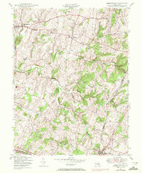
1944 Map of Libertytown
USGS Topo · Published 1972About this map
The agricultural landscape along the boundary of Frederick and Carroll Counties is defined by a dense network of watercourses feeding into Linganore Creek. Small rural crossroads and hamlets such as Unionville, Oak Orchard, and Harrisville punctuate the rolling terrain, connected by a maturing road system that saw significant updates during the mid-20th century. To the south, Mount Airy serves as a primary hub, influenced by the presence of the Baltimore and Ohio railroad corridor which skirts the southern edge of this region.
Find a feature on this map
23 named features on this map. Tap any name to fly to it.
Don’t see what you’re looking for? This feature index may not catch every label — zoom into the map to look around manually.
Map Details
Editions of this 1944 Libertytown Map
4 editions found
Other maps of this area

1893 · Frederick
USGS Topo · 1:125,000

1894 · Frederick
USGS Topo · 1:125,000

1908 · Ijamsville
USGS Topo · 1:62,500

1909 · Mount Airy
USGS Topo · 1:62,500

1909 · Ijamsville
USGS Topo · 1:62,500

1911 · Taneytown
USGS Topo · 1:62,500

1911 · Emmitsburg
USGS Topo · 1:62,500

1942 · Frederick
USGS Topo · 1:62,500

1942 · Gettysburg
USGS Topo · 1:125,000

1943 · Emmitsburg
USGS Topo · 1:62,500