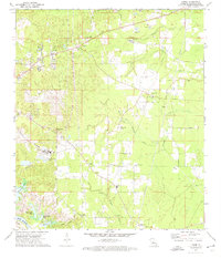
1972 Map of Libuse
USGS Topo · Published 1974About this map
The Czechoslovakian heritage of Rapides Parish is clearly visible in the early 1970s through the settlements of Libuse and Kolin. This area northeast of the Red River reflects a distinct cultural landscape, evidenced by the Libuse Czech Cem and the Czech National Cem. Agriculture and timber interests define the land use, with the Libuse Lookout Tower standing watch over the mixed woods and small clearings.
Find a feature on this map
35 named features on this map. Tap any name to fly to it.
Don’t see what you’re looking for? This feature index may not catch every label — zoom into the map to look around manually.
Map Details
Editions of this 1972 Libuse Map
2 editions found
Other maps of this area

1935 · Lecompte
USGS Topo · 1:62,500

1940 · Marksville
USGS Topo · 1:62,500

1941 · Alexandria
USGS Topo · 1:62,500

1941 · Buckeye
USGS Topo · 1:62,500

1953 · Alexandria
USGS Topo · 1:250,000

1955 · Alexandria
USGS Topo · 1:250,000

1957 · Alexandria
USGS Topo · 1:62,500
1957 · Alexandria
USGS Topo · 1:24,000

1957 · Lecompte
USGS Topo · 1:62,500

1959 · Buckeye
USGS Topo · 1:62,500