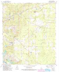
1972 Map of Libuse
USGS Topo · Published 1993About this map
The immigrant heritage of central Louisiana is strikingly visible on this map of Libuse and Kolin, settlements founded by Czech and Slovak families. The cultural imprint is preserved through numerous community landmarks, including the Libuse Czech Cem, the Czech National Cem, and the Philadelphia Ch. This rural landscape is defined by the transition from the high ground near the Libuse Lookout Tower down toward the alluvial plains of the Red River.
Find a feature on this map
35 named features on this map. Tap any name to fly to it.
Don’t see what you’re looking for? This feature index may not catch every label — zoom into the map to look around manually.
Map Details
Editions of this 1972 Libuse Map
2 editions found
Other maps of this area

1935 · Lecompte
USGS Topo · 1:62,500

1940 · Marksville
USGS Topo · 1:62,500

1941 · Alexandria
USGS Topo · 1:62,500

1941 · Buckeye
USGS Topo · 1:62,500

1953 · Alexandria
USGS Topo · 1:250,000

1955 · Alexandria
USGS Topo · 1:250,000

1957 · Alexandria
USGS Topo · 1:62,500
1957 · Alexandria
USGS Topo · 1:24,000

1957 · Lecompte
USGS Topo · 1:62,500

1959 · Buckeye
USGS Topo · 1:62,500