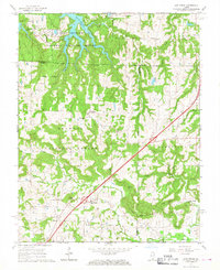
1966 Map of Lick Creek
USGS Topo · Published 1967About this map
Shawnee National Forest dominates the rugged southern Illinois landscape, where the confluence of several county lines meets the emerging Interstate 57 corridor. This mid-1960s survey captures the area as the I-57 highway cuts a diagonal path through the timbered hills, forever changing the transit patterns between Lick Creek and Goreville. The map is particularly dense with genealogical sites, showing numerous family-named landmarks and rural congregations such as Mt Hebron Ch, Palestine Ch, and the Lick Creek Sch.
Find a feature on this map
46 named features on this map. Tap any name to fly to it.
Don’t see what you’re looking for? This feature index may not catch every label — zoom into the map to look around manually.
Map Details
Editions of this 1966 Lick Creek Map
3 editions found
Other maps of this area

1918 · Vienna
USGS Topo · 1:62,500

1919 · Vienna
USGS Topo · 1:62,500

1920 · Dongola
USGS Topo · 1:62,500

1922 · Carbondale
USGS Topo · 1:62,500

1923 · Dongola
USGS Topo · 1:62,500

1925 · Marion
USGS Topo · 1:62,500

1940 · Marion
USGS Topo · 1:62,500

1941 · Carbondale
USGS Topo · 1:62,500

1942 · Vienna
USGS Topo · 1:62,500

1949 · Paducah
USGS Topo · 1:250,000