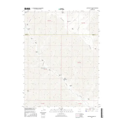
2017 Map of Lighthouse Canyon
USGS Topo · Published 2017About this map
Range Cr flows through the center of this terrain-dominated landscape on the border of Carbon and Emery Counties. The 2017 survey details a high-elevation environment defined by a dense network of deep drainages, including the prominent Lighthouse Canyon and Nelson Canyon. The presence of the Tavapats Ranch Airport on the northern plateau indicates the area's isolation and the necessity of aerial access to this high desert country. Roadways like Range Creek Rd and Range Valley Mountain Rd trace the ridgelines and canyon floors, providing the primary overland routes between named features like Barton Canyon and Gooseberry Canyon. This map is particularly useful for understanding the complex hydrology and topography of the Book Cliffs region, where dramatic elevation changes are named with local identifiers such as Twin Springs Draw and Cherry Meadow Cherry Meadow Canyon.
Find a feature on this map
30 named features on this map. Tap any name to fly to it.
Don’t see what you’re looking for? This feature index may not catch every label — zoom into the map to look around manually.
Map Details
Editions of this 2017 Lighthouse Canyon Map
This is the sole edition of this map. No revisions or reprints were ever made.
Other maps of this area

1886 · Price River
USGS Topo · 1:250,000

1896 · Price River
USGS Topo · 1:250,000

1915 · Sunnyside
USGS Topo · 1:62,500

1948 · Woodside
USGS Topo · 1:62,500

1949 · Woodside
USGS Topo · 1:62,500

1950 · Woodside
USGS Topo · 1:62,500

1954 · Flat Canyon
USGS Topo · 1:62,500

1954 · Range Creek
USGS Topo · 1:62,500

1956 · Price
USGS Topo · 1:250,000

1960 · Price
USGS Topo · 1:250,000