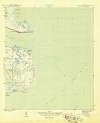
1945 Map of Lighthouse Point
USGS Topo · Published 1945About this map
Ochlockonee Fishery, Sunday Reel Fishery, and Mud Cove Fishery anchor this coastal landscape, reflecting the maritime economy of the Florida Panhandle during the mid-1940s. The geography is defined by the meeting of Ochlockonee Bay and the Gulf of Mexico, with St James Island and Mashes Island separated by the winding course of Chaires Creek.
Find a feature on this map
25 named features on this map. Tap any name to fly to it.
Don’t see what you’re looking for? This feature index may not catch every label — zoom into the map to look around manually.
Map Details
Editions of this 1945 Lighthouse Point Map
3 editions found
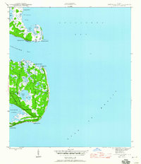
Other maps of this area

1940 · Arran
USGS Topo · 1:62,500

1943 · Arran
USGS Topo · 1:62,500

1943 · St. Teresa Beach
USGS Topo · 1:24,000

1943 · Lighthouse Point
USGS Topo · 1:24,000

1945 · Lighthouse Point
USGS Topo · 1:31,680

1945 · St Teresa
USGS Topo · 1:31,680

1949 · Apalachicola
USGS Topo · 1:250,000

1954 · Sprague Island
USGS Topo · 1:24,000

1954 · Tallahassee
USGS Topo · 1:250,000

1957 · Apalachicola
USGS Topo · 1:250,000