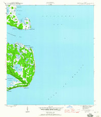
1945 Map of Lighthouse Point
USGS Topo · Published 1960About this map
Ochlockonee Fishery and Sunday Reel Fishery anchor this coastal survey, reflecting an era when the seafood industry defined the local economy of St James Island. The map documents a labyrinth of tidal creeks and marshlands where Big Chaires Creek and Chaires Cr snake through the low-lying terrain. This 1940s landscape is characterized by its numerous freshwater and brackish bodies, such as Tucker Lake, Sand Pond, and Double Pond, which sit just inland from the saltwater of Alligator Harbor.
Find a feature on this map
24 named features on this map. Tap any name to fly to it.
Don’t see what you’re looking for? This feature index may not catch every label — zoom into the map to look around manually.
Map Details
Editions of this 1945 Lighthouse Point Map
3 editions found
Other maps of this area

1940 · Arran
USGS Topo · 1:62,500

1943 · Arran
USGS Topo · 1:62,500

1943 · St. Teresa Beach
USGS Topo · 1:24,000

1943 · Lighthouse Point
USGS Topo · 1:24,000

1945 · Lighthouse Point
USGS Topo · 1:31,680

1945 · St Teresa
USGS Topo · 1:31,680

1949 · Apalachicola
USGS Topo · 1:250,000

1954 · Sprague Island
USGS Topo · 1:24,000

1954 · Tallahassee
USGS Topo · 1:250,000

1957 · Apalachicola
USGS Topo · 1:250,000