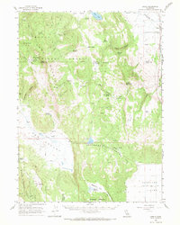
1962 Map of Likely
USGS Topo · Published 1971About this map
The Pit River flows through the northeastern corner of this high-elevation landscape, where the settlement of Likely sits along the Southern Pacific railroad line. This territory is defined by the intersection of the Modoc National Forest and the vast Madeline Plains, characterized by a complex network of seasonal drainages and springs. The map documents the high-desert sheep-ranching culture of the early 1960s, marking remote outposts like Portuguese Sheep Camp and Fleming Sheep Camp.
Find a feature on this map
55 named features on this map. Tap any name to fly to it.
Don’t see what you’re looking for? This feature index may not catch every label — zoom into the map to look around manually.
Map Details
Editions of this 1962 Likely Map
2 editions found

Other maps of this area

1886 · Alturas
USGS Topo · 1:250,000

1886 · Honey Lake
USGS Topo · 1:250,000

1891 · Honey Lake
USGS Topo · 1:250,000

1892 · Alturas
USGS Topo · 1:250,000

1893 · Honey Lake
USGS Topo · 1:250,000

1954 · Grasshopper Valley
USGS Topo · 1:62,500

1954 · Ravendale
USGS Topo · 1:62,500

1954 · Alturas
USGS Topo · 1:250,000

1955 · Westwood
USGS Topo · 1:250,000

1956 · Hayden Hill
USGS Topo · 1:62,500