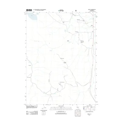
2012 Map of Likely
USGS Topo · Published 2012About this map
Likely and the surrounding high desert of Modoc County are defined by a network of ranching homesteads and vital water sources in this 2012 survey. Named ranching sites like D Flourney, K Flourney, and R Flourney suggest a landscape dominated by family-run agriculture, while the presence of the Likely Cem and a dedicated Po (Post Office) mark the community's local center. The South Fork Pit River and Dry Creek provide the primary drainage for the area, supplemented by numerous springs such as Smokey Charley Spring and Cottonwood Springs. The terrain rises from the flats of Alkali Lake and Delta Lake in the northwest to prominent volcanic peaks, including Bald Mountain, Little Bald Mountain, and Likely Mountain. This map provides a detailed view of the infrastructure of the rural north, from the Likely Airport to remote routes like S Fork Mountain Rd.
Find a feature on this map
34 named features on this map. Tap any name to fly to it.
Don’t see what you’re looking for? This feature index may not catch every label — zoom into the map to look around manually.
Map Details
Editions of this 2012 Likely Map
This is the sole edition of this map. No revisions or reprints were ever made.
Other maps of this area

1886 · Alturas
USGS Topo · 1:250,000

1892 · Alturas
USGS Topo · 1:250,000

1954 · Alturas
USGS Topo · 1:250,000

1958 · Alturas
USGS Topo · 1:250,000

1961 · Alturas
USGS Topo · 1:62,500

1962 · Alturas
USGS Topo · 1:250,000

1962 · Tule Mountain
USGS Topo · 1:24,000
1962 · Madeline
USGS Topo · 1:24,000

1962 · Likely
USGS Topo · 1:62,500

1963 · Little Juniper Reservoir
USGS Topo · 1:24,000