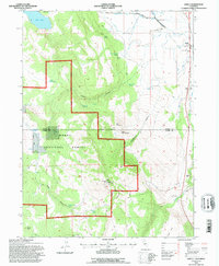
1993 Map of Likely
USGS Topo · Published 1996About this map
Likely stands as a focal point at the edge of the high desert and timbered slopes, situated where the South Fork Pit River winds through a valley defined by early irrigation and ranching. This 1993 revision by the Forest Service illustrates a landscape of managed water, with the Eastside Ditch and various canals supporting the valley while the western terrain rises sharply into the Modoc National Forest. Significant local landmarks include the South Fork Union Sch and the Cem just south of town, anchoring the community's history in this remote corner of Northern California.
Find a feature on this map
40 named features on this map. Tap any name to fly to it.
Don’t see what you’re looking for? This feature index may not catch every label — zoom into the map to look around manually.
Map Details
Editions of this 1993 Likely Map
This is the sole edition of this map. No revisions or reprints were ever made.
Other maps of this area

1886 · Alturas
USGS Topo · 1:250,000

1892 · Alturas
USGS Topo · 1:250,000

1954 · Alturas
USGS Topo · 1:250,000

1958 · Alturas
USGS Topo · 1:250,000

1961 · Alturas
USGS Topo · 1:62,500

1962 · Alturas
USGS Topo · 1:250,000

1962 · Tule Mountain
USGS Topo · 1:24,000
1962 · Madeline
USGS Topo · 1:24,000

1962 · Likely
USGS Topo · 1:62,500

1963 · Little Juniper Reservoir
USGS Topo · 1:24,000