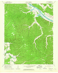
1966 Map of Lillamay
USGS Topo · Published 1967About this map
Cheatham State Wildlife Management Area dominates the central landscape of this 1966 survey, a territory marked by deep drainages and ridges between the Cumberland River and Harpeth River. To the south, the Harpeth forms a dramatic oxbow at Horseshoe Bend and the narrow ridge known as The Narrows, an area significant for its prehistoric archaeology including the Indian Mounds at Mound Bottom. Settlement is concentrated along the waterways and valley floors, from the small community of Lillamay near Cheatham Lake to Shacklett on the southern edge. The map preserves several family and community landmarks, such as Sams Creek Ch, Scott Cem, and Carney Cem, which are vital for local genealogical research. This era shows the influence of the U S Reservation Boundary and several utility pipelines traversing the wooded hills, reflecting the region's managed conservation and infrastructure development during the mid-1960s.
Find a feature on this map
32 named features on this map. Tap any name to fly to it.
Don’t see what you’re looking for? This feature index may not catch every label — zoom into the map to look around manually.
Map Details
Editions of this 1966 Lillamay Map
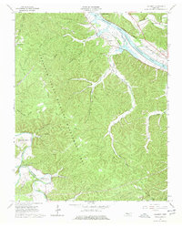
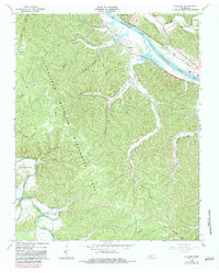
3 editions found
Other maps of this area

1903 · Nashville
USGS Topo · 1:125,000

1930 · White Bluff
USGS Topo · 1:62,500

1931 · Ridgetop
USGS Topo · 1:62,500

1932 · Nashville
USGS Topo · 1:62,500

1933 · White Bluff
USGS Topo · 1:62,500

1935 · Ridgetop
USGS Topo · 1:62,500

1955 · Forest Grove
USGS Topo · 1:24,000

1955 · Scottsboro
USGS Topo · 1:24,000
1955 · Belleview
USGS Topo · 1:24,000

1956 · Nashville
USGS Topo · 1:250,000