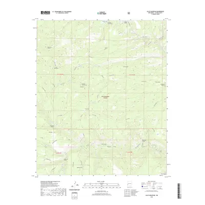
2020 Map of Lilley Mountain
USGS Topo · Published 2020About this map
Gila National Forest encompasses this wilderness area where the Middle Fork Gila River and the W Fork Gila River carve through high desert mesas. The landscape is defined by its isolation, punctuated only by a few named campsites and remote points of interest like McKenna Park and Pine Flat. A solitary historical marker, the Papineau Grave, sits near the head of Swinging Cross Canyon, a testament to the lone individuals who moved through these canyons.
Find a feature on this map
52 named features on this map. Tap any name to fly to it.
Don’t see what you’re looking for? This feature index may not catch every label — zoom into the map to look around manually.
Map Details
Editions of this 2020 Lilley Mountain Map
This is the sole edition of this map. No revisions or reprints were ever made.
Other maps of this area

1910 · Mogollon
USGS Topo · 1:125,000

1911 · Alum Mountain
USGS Topo · 1:125,000

1912 · Mogollon
USGS Topo · 1:125,000

1913 · Alum Mountain
USGS Topo · 1:125,000

1954 · Clifton
USGS Topo · 1:250,000

1957 · Clifton
USGS Topo · 1:250,000

1958 · Clifton
USGS Topo · 1:250,000

1962 · Clifton
USGS Topo · 1:250,000

1963 · Negrito Mountain
USGS Topo · 1:24,000
1963 · Loco Mountain
USGS Topo · 1:24,000