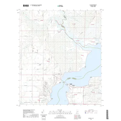
2018 Map of Lillian
USGS Topo · Published 2018About this map
Lillian sits at the critical maritime junction where the Perdido River opens into the expansive waters of Perdido Bay, marking the coastal boundary between Alabama and Florida. This 2018 survey reveals a landscape defined by its intricate wetlands and bayous, including the dense Lillian Swamp and Juniper Swamp to the north. The area's aviation history is represented by the presence of Shields Airport and Ban Farm Airport, while local genealogy is anchored by the Gilley Memorial Cem near the upper reaches of Narrow Gap Creek.
Find a feature on this map
122 named features on this map. Tap any name to fly to it.
Don’t see what you’re looking for? This feature index may not catch every label — zoom into the map to look around manually.
Map Details
Editions of this 2018 Lillian Map
This is the sole edition of this map. No revisions or reprints were ever made.
Other maps of this area

1920 · Robertsdale
USGS Topo · 1:62,500

1921 · Bon Secour
USGS Topo · 1:62,500

1921 · Fort Barrancas
USGS Topo · 1:62,500

1921 · Muscogee
USGS Topo · 1:62,500

1941 · Fort Barrancas
USGS Topo · 1:62,500

1941 · Muscogee
USGS Topo · 1:62,500

1941 · Robertsdale
USGS Topo · 1:62,500

1941 · Foley
USGS Topo · 1:62,500

1943 · Robertsdale
USGS Topo · 1:62,500

1943 · Muscogee
USGS Topo · 1:62,500