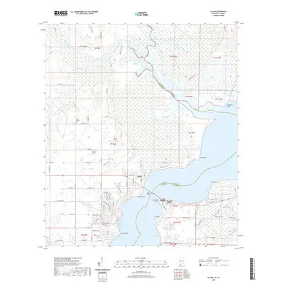
2020 Map of Lillian
USGS Topo · Published 2020About this map
Perdido Bay and the winding Perdido River dominate this coastal landscape at the border of Alabama and Florida. The settlement of Lillian serves as a central hub, connected by the Lillian Bridge to the eastern shores of Escambia County. To the north, the terrain becomes increasingly marshy, defined by the Blackwater River and the extensive Lillian Swamp. This geography influenced a development pattern of small communities like Perdido Heights and Paradise Beach hugging the southern bayfront, while the interior remains characterized by more dispersed landmarks.
Find a feature on this map
115 named features on this map. Tap any name to fly to it.
Don’t see what you’re looking for? This feature index may not catch every label — zoom into the map to look around manually.
Map Details
Editions of this 2020 Lillian Map
This is the sole edition of this map. No revisions or reprints were ever made.
Other maps of this area

1920 · Robertsdale
USGS Topo · 1:62,500

1921 · Bon Secour
USGS Topo · 1:62,500

1921 · Fort Barrancas
USGS Topo · 1:62,500

1921 · Muscogee
USGS Topo · 1:62,500

1941 · Fort Barrancas
USGS Topo · 1:62,500

1941 · Muscogee
USGS Topo · 1:62,500

1941 · Robertsdale
USGS Topo · 1:62,500

1941 · Foley
USGS Topo · 1:62,500

1943 · Robertsdale
USGS Topo · 1:62,500

1943 · Muscogee
USGS Topo · 1:62,500