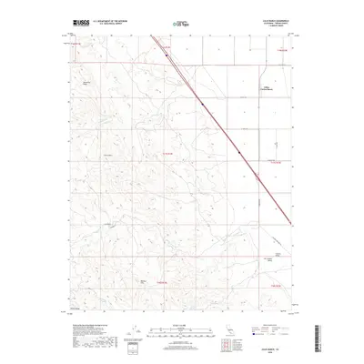
2018 Map of Lillis Ranch
USGS Topo · Published 2018About this map
Giffen Cantua Ranch and Lillis Ranch define the agricultural and pastoral footprint of this Fresno County landscape, where the flat floor of the San Joaquin Valley meets the rising slopes of the Diablo Range. The terrain transitions sharply from the organized grid of the Central Valley to the complex topography of the Ciervo Hills and Big Blue Hills. This geography is shaped by intermittent drainages such as Arroyo Hondo and Cantua Creek, which cut through Monocline Ridge. Water sources like Green Water Spring and Sulphur Spring provide critical landmarks in an area dominated by large-scale ranching and the transit corridor of the Coalinga-Mendota Road. The map preserves the specific boundary lines of the Public Land Survey System, illustrating how township and range divisions dictated the layout of roads like S Derrick Ave and W Elkhorn Ave.
Find a feature on this map
29 named features on this map. Tap any name to fly to it.
Don’t see what you’re looking for? This feature index may not catch every label — zoom into the map to look around manually.
Map Details
Editions of this 2018 Lillis Ranch Map
This is the sole edition of this map. No revisions or reprints were ever made.
Other maps of this area

1912 · Coalinga
USGS Topo · 1:125,000

1913 · Panoche
USGS Topo · 1:125,000

1915 · Priest Valley
USGS Topo · 1:125,000

1923 · Levis
USGS Topo · 1:31,680

1923 · Englebrecht Ranch
USGS Topo · 1:31,680

1923 · Monocline Ridge
USGS Topo · 1:31,680

1931 · Mouth of Cantua Creek
USGS Topo · 1:31,680

1943 · New Idria
USGS Topo · 1:62,500

1943 · Joaquin Rocks
USGS Topo · 1:62,500

1946 · Tranquillity
USGS Topo · 1:62,500