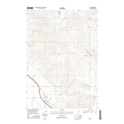
2017 Map of Lima
USGS Topo · Published 2017About this map
Lima serves as the primary hub in this corner of Beaverhead County, positioned where the Red Rock River Valley meets a complex network of mountain drainages. The landscape is defined by the convergence of several significant waterways, including Junction Cr, Alder Cr, and Willow Cr, which flow toward the main river channel. This 2017 survey reflects a contemporary view of the valley's transit and infrastructure, following the path of Old Us Hwy 91 and various rural connectors like Little Sheep Creek Rd and Sage Creek Rd. Local heritage is anchored by the Mount Moriah Cem just east of the town center. To the northeast, the terrain opens into Antelope Flat, illustrating the transition from the river bottomlands to the elevated plateaus that characterize this section of the Montana high country.
Find a feature on this map
35 named features on this map. Tap any name to fly to it.
Don’t see what you’re looking for? This feature index may not catch every label — zoom into the map to look around manually.
Map Details
Editions of this 2017 Lima Map
This is the sole edition of this map. No revisions or reprints were ever made.
Other maps of this area

1955 · Dubois
USGS Topo · 1:250,000

1958 · Dubois
USGS Topo · 1:250,000

1965 · Gallagher Gulch
USGS Topo · 1:24,000

1965 · Lima
USGS Topo · 1:24,000

1965 · Briggs Ranch
USGS Topo · 1:24,000

1965 · Rock Island Ranch
USGS Topo · 1:24,000

1965 · Dell
USGS Topo · 1:24,000

1965 · Lima Peaks
USGS Topo · 1:24,000

1968 · Snowline
USGS Topo · 1:24,000

1968 · Vinegar Hill
USGS Topo · 1:24,000