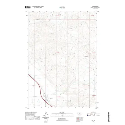
2020 Map of Lima
USGS Topo · Published 2020About this map
Lima serves as the central hub of this Beaverhead County landscape, situated where the Red Rock River Valley meets the high desert terrain of southwestern Montana. The town's grid is clearly defined by streets such as N Main St and Broadway St, with the Mount Moriah Cem located on its southeastern edge. The map captures a transition from the level basin of Antelope Flat to the surrounding foothills, which are carved by seasonal and perennial watercourses like Willow Creek, Birch Cr, and Sage Cr.
Find a feature on this map
35 named features on this map. Tap any name to fly to it.
Don’t see what you’re looking for? This feature index may not catch every label — zoom into the map to look around manually.
Map Details
Editions of this 2020 Lima Map
This is the sole edition of this map. No revisions or reprints were ever made.
Other maps of this area

1955 · Dubois
USGS Topo · 1:250,000

1958 · Dubois
USGS Topo · 1:250,000

1965 · Gallagher Gulch
USGS Topo · 1:24,000

1965 · Lima
USGS Topo · 1:24,000

1965 · Briggs Ranch
USGS Topo · 1:24,000

1965 · Rock Island Ranch
USGS Topo · 1:24,000

1965 · Dell
USGS Topo · 1:24,000

1965 · Lima Peaks
USGS Topo · 1:24,000

1968 · Snowline
USGS Topo · 1:24,000

1968 · Vinegar Hill
USGS Topo · 1:24,000