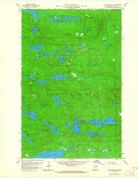
1959 Map of Lima Mountain
USGS Topo · Published 1965About this map
Misquah Hills dominate this portion of the Superior National Forest in the late 1950s, a landscape defined by high ridges and a dense network of glacial lakes. The topography is anchored by Lima Mountain and its prominent Lookout Tower, overseeing a wilderness where the Brule River and South Brule River carve through the timberland. An Old Railroad Grade winds through the center of the sheet near Skidway Lake and Dugout Lake, reflecting the region’s logging heritage and early transportation corridors.
Find a feature on this map
66 named features on this map. Tap any name to fly to it.
Don’t see what you’re looking for? This feature index may not catch every label — zoom into the map to look around manually.
Map Details
Editions of this 1959 Lima Mountain Map
3 editions found
Other maps of this area

1919 · Brule Lake
USGS Topo · 1:62,500

1954 · Two Harbors
USGS Topo · 1:250,000

1957 · Two Harbors
USGS Topo · 1:250,000

1957 · Quetico
USGS Topo · 1:250,000

1958 · Two Harbors
USGS Topo · 1:250,000

1959 · Pine Mountain
USGS Topo · 1:24,000

1959 · Lima Mountain
USGS Topo · 1:24,000

1959 · Hungry Jack Lake
USGS Topo · 1:24,000

1959 · Crocodile Lake
USGS Topo · 1:24,000

1960 · Grand Marais
USGS Topo · 1:24,000