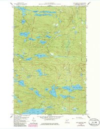
1959 Map of Lima Mountain
USGS Topo · Published 1986About this map
The Misquah Hills dominate this portion of the Superior National Forest, presenting a complex landscape of glacial lakes and high ridges at the end of the 1950s. This survey captures the boundary between the State Forest and the Boundary Waters Canoe Area Wilderness, where water bodies like Vista Lake, Little Trout Lake, and Marshall Lake form a dense network of interior waterways. The topography is defined by significant elevations, including Lima Mountain and Brule Mountain, which watch over the winding course of the Brule River. Evidence of earlier resource extraction and transport is still visible on the landscape, notably the Old Railroad Grade and several identified Gravel Pits. The map also documents recreational development at the Two Island Lake Campground, situated near the southern edge of this wilderness region, providing a specific look at the intersection of natural conservation and early forest management.
Find a feature on this map
58 named features on this map. Tap any name to fly to it.
Don’t see what you’re looking for? This feature index may not catch every label — zoom into the map to look around manually.
Map Details
Editions of this 1959 Lima Mountain Map
3 editions found
Other maps of this area

1919 · Brule Lake
USGS Topo · 1:62,500

1954 · Two Harbors
USGS Topo · 1:250,000

1957 · Two Harbors
USGS Topo · 1:250,000

1957 · Quetico
USGS Topo · 1:250,000

1958 · Two Harbors
USGS Topo · 1:250,000

1959 · Pine Mountain
USGS Topo · 1:24,000

1959 · Lima Mountain
USGS Topo · 1:24,000

1959 · Hungry Jack Lake
USGS Topo · 1:24,000

1959 · Crocodile Lake
USGS Topo · 1:24,000

1960 · Grand Marais
USGS Topo · 1:24,000