
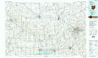
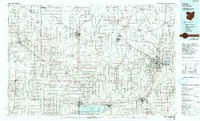
1986 Map of Lima
USGS Topo · Published 1986About this map
The Auglaize River and St Marys River anchor the drainage of this West Ohio and East Indiana borderlands region during the mid-1980s. Centered on the industrial and transit hub of Lima, the landscape is a grid of agricultural townships interconnected by the Conrail and Norfolk And Western railroad networks. To the southwest, the expansive Grand Lake-St Marys dominates the horizon, supported by the St Marys State Fish Farm and the Mercer County Waterfowl Management Area. This survey provides significant industrial and institutional detail, from the Lima Ordnance Modification Center to the Ohio State Univ Lima Campus. Smaller agricultural centers like Van Wert, Celina, and Wapakoneta serve as focal points for the surrounding rural sections. The map reveals a highly engineered landscape, where numerous quarries and drainage features like Flatrock Creek and Blue Creek define the local topography between the scattered woodlots and family-named cemeteries.
Find a feature on this map
214 named features on this map. Tap any name to fly to it.
Don’t see what you’re looking for? This feature index may not catch every label — zoom into the map to look around manually.
Map Details
Editions of this 1986 Lima Map
3 editions found
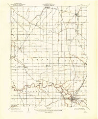
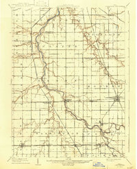
Other maps of this area

1906 · Lima
USGS Topo · 1:62,500

1906 · Columbus Grove
USGS Topo · 1:62,500

1907 · Bluffton
USGS Topo · 1:62,500

1908 · Columbus Grove
USGS Topo · 1:62,500
1908 · Ottawa
USGS Topo · 1:62,500

1908 · St. Henry
USGS Topo · 1:62,500
1909 · Continental
USGS Topo · 1:62,500

1909 · Loramie
USGS Topo · 1:62,500

1911 · Berne
USGS Topo · 1:48,000

1911 · Loramie
USGS Topo · 1:62,500