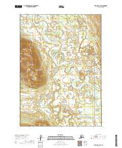
2019 Map of Lime Hills A-4 SW
USGS Topo · Published 2019About this map
The Stony River meanders across this wilderness landscape in the Bethel Census Area, where glacial-fed waterways define the shifting terrain. This interior region is characterized by the confluence of major river systems, including the Telaquana River and the winding Tunkaleshna Cr, which carve through a mosaic of wetlands and alluvial flats. A significant portion of the southeast corner is protected within the Lake Clark National Preserve, highlighting the region's importance as an undisturbed ecosystem. The lack of infrastructure and named settlements on this 2019 survey reflects the remote character of the Alaska Range foothills, where the land remains managed primarily by federal agencies like the U.S. Geological Survey and the Bureau of Land Management. Researchers can study the intricate drainage patterns and hydrological shifts that occur between the higher elevations and the broad river valleys.
Find a feature on this map
8 named features on this map. Tap any name to fly to it.
Don’t see what you’re looking for? This feature index may not catch every label — zoom into the map to look around manually.
Map Details
Editions of this 2019 Lime Hills A-4 SW Map
This is the sole edition of this map. No revisions or reprints were ever made.
Other maps of this area

1946 · Lake Clark
USGS Topo · 1:250,000

1951 · Lake Clark
USGS Topo · 1:250,000

1951 · Lime Hills
USGS Topo · 1:250,000

1954 · Lime Hills A-5
USGS Topo · 1:63,360

1954 · Lime Hills A-4
USGS Topo · 1:63,360

1954 · Lake Clark D-5
USGS Topo · 1:63,360

1954 · Lake Clark D-4
USGS Topo · 1:63,360

1958 · Lake Clark
USGS Topo · 1:250,000

1958 · Lime Hills
USGS Topo · 1:250,000
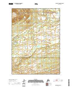
2018 · Lake Clark D-4 NW
USGS Topo · 1:25,000