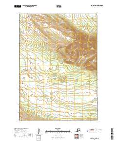
2019 Map of Lime Hills A-5 SE
USGS Topo · Published 2019About this map
Can Creek winds through this unpopulated portion of the t11n r30w and t12n r30w townships in the Bethel Census Area. The landscape is defined by significant elevation changes, with the northern reaches rising towards high ridges while the southern portion levels out into a complex network of wetlands and drainage basins. This 2019 survey, produced using SPOT imagery and National Hydrography Dataset records, illustrates the natural water paths and terrain before any modern road infrastructure or named settlements reached this part of the Lime Hills. The absence of human-named landmarks beyond the creek emphasizes the wilderness character of the region, where the primary identifiers remain the Public Land Survey System grids like t12n r29w and t11n r31w.
Find a feature on this map
5 named features on this map. Tap any name to fly to it.
Don’t see what you’re looking for? This feature index may not catch every label — zoom into the map to look around manually.
Map Details
Editions of this 2019 Lime Hills A-5 SE Map
This is the sole edition of this map. No revisions or reprints were ever made.
Other maps of this area

1946 · Lake Clark
USGS Topo · 1:250,000

1951 · Lake Clark
USGS Topo · 1:250,000

1951 · Lime Hills
USGS Topo · 1:250,000

1954 · Lime Hills A-5
USGS Topo · 1:63,360

1954 · Lime Hills A-4
USGS Topo · 1:63,360

1954 · Lake Clark D-5
USGS Topo · 1:63,360

1954 · Lake Clark D-4
USGS Topo · 1:63,360

1958 · Lake Clark
USGS Topo · 1:250,000

1958 · Lime Hills
USGS Topo · 1:250,000
2018 · Lake Clark D-4 NW
USGS Topo · 1:25,000