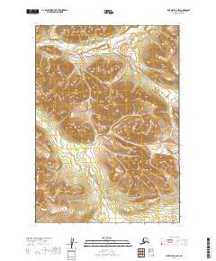
2019 Map of Lime Hills A-6 SW
USGS Topo · Published 2019About this map
Hook Creek flows through the northern reaches of this Alaskan interior landscape within the Bethel Census Area. The terrain is characterized by significant elevation changes, with ridges rising steeply above the drainage basins. While the map is notably devoid of human settlements, schools, or structures, it meticulously documents the township and range boundaries of t12n r34w, t12n r33w, t11n r34w, and t11n r33w. This 2019 survey provides a precise look at the natural drainage patterns and topographical contours of a remote region prior to any significant infrastructure development.
Find a feature on this map
5 named features on this map. Tap any name to fly to it.
Don’t see what you’re looking for? This feature index may not catch every label — zoom into the map to look around manually.
Map Details
Editions of this 2019 Lime Hills A-6 SW Map
This is the sole edition of this map. No revisions or reprints were ever made.
Other maps of this area

1946 · Lake Clark
USGS Topo · 1:250,000

1951 · Lake Clark
USGS Topo · 1:250,000

1951 · Lime Hills
USGS Topo · 1:250,000

1954 · Lake Clark D-7
USGS Topo · 1:63,360

1954 · Lime Hills A-7
USGS Topo · 1:63,360

1954 · Lime Hills A-6
USGS Topo · 1:63,360
1954 · Lake Clark D-6
USGS Topo · 1:63,360

1958 · Lake Clark
USGS Topo · 1:250,000

1958 · Lime Hills
USGS Topo · 1:250,000
2019 · Lake Clark D-6 NW
USGS Topo · 1:25,000