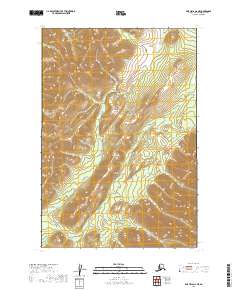
2019 Map of Lime Hills D-6 NE
USGS Topo · Published 2019About this map
Shoeleather Cr dominates this interior landscape, carving a winding path through the complex elevation of the Lime Hills. The terrain is defined by a dense network of ridges and drainages that converge toward the creek as it flows through the intersections of t21n r32w, t21n r31w, t22n r31w, and t22n r32w. The absence of developed roads or structures emphasizes the isolation of this portion of the Bethel Census Area. Researchers can observe how the local topography dictates the hydrology of the region, where every minor draw and spur contributes to the Shoeleather drainage system, creating a pristine record of subarctic geomorphology in the early twenty-first century.
Find a feature on this map
5 named features on this map. Tap any name to fly to it.
Don’t see what you’re looking for? This feature index may not catch every label — zoom into the map to look around manually.
Map Details
Editions of this 2019 Lime Hills D-6 NE Map
This is the sole edition of this map. No revisions or reprints were ever made.
Other maps of this area

1949 · McGrath
USGS Topo · 1:250,000

1950 · McGrath
USGS Topo · 1:250,000

1951 · Lime Hills
USGS Topo · 1:250,000

1954 · McGrath A-4
USGS Topo · 1:63,360

1954 · Lime Hills D-6
USGS Topo · 1:63,360

1954 · Lime Hills D-5
USGS Topo · 1:63,360
1954 · McGrath A-5
USGS Topo · 1:63,360

1958 · McGrath
USGS Topo · 1:250,000

1958 · Lime Hills
USGS Topo · 1:250,000
2019 · Lime Hills D-5 SW
USGS Topo · 1:25,000