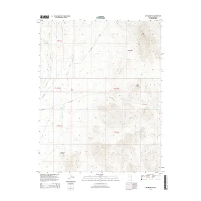
2014 Map of Lime Mountain
USGS Topo · Published 2014About this map
Lime Mtn rises above the transition between the Tule Desert and the Tule Springs Hills, anchoring a landscape defined by seasonal water systems and sparse desert tracks. The drainage patterns of Garden Wash, Sams Camp Wash, and the network surrounding Snow Spring illustrate the critical importance of water management in this arid stretch of Lincoln County. Artificial water features such as Sams Camp Reservoir, Middle Pond Reservoir, and the Snow Trough suggest historical or modern ranching use, where traditional springs like Gordon Spring and Jones Spring have long served as vital landmarks. Remote thoroughfares including Lime Mountain Rd and Snow Spring Rd provide the only access through these township and range divisions, connecting isolated points like Jones Spring Point to the broader regional geography.
Find a feature on this map
20 named features on this map. Tap any name to fly to it.
Don’t see what you’re looking for? This feature index may not catch every label — zoom into the map to look around manually.
Map Details
Editions of this 2014 Lime Mountain Map
This is the sole edition of this map. No revisions or reprints were ever made.
Other maps of this area

1885 · Pioche
USGS Topo · 1:250,000

1886 · Pioche
USGS Topo · 1:250,000

1954 · Caliente
USGS Topo · 1:250,000

1959 · Caliente
USGS Topo · 1:250,000
1973 · Jacks Mountain
USGS Topo · 1:24,000
1973 · Tule Spring
USGS Topo · 1:24,000
1973 · Scarecrow Peak
USGS Topo · 1:24,000
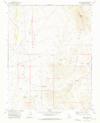
1973 · Lime Mountain
USGS Topo · 1:24,000
1973 · Terry Benches
USGS Topo · 1:24,000
1973 · Toquop Gap
USGS Topo · 1:24,000