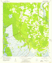
1955 Map of Limehouse
USGS Topo · Published 1957About this map
Savannah National Wildlife Refuge dominates the southwestern quadrant of this coastal landscape, where the Savannah River divides into the Argyle Back River and Little Back River. The terrain is defined by an intricate network of waterways and managed wetlands, including the Lucknow Canal and Taylor Canal, which reflect a long history of hydrologic engineering in the Lowcountry. In the mid-1950s, the rural character of Jasper County is marked by small settlements and numerous family-named cemeteries such as Parker Cem and Hardy Cem.
Find a feature on this map
52 named features on this map. Tap any name to fly to it.
Don’t see what you’re looking for? This feature index may not catch every label — zoom into the map to look around manually.
Map Details
Editions of this 1955 Limehouse Map
2 editions found
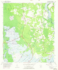
Other maps of this area

1920 · Hardeeville
USGS Topo · 1:62,500

1920 · Okatie
USGS Topo · 1:62,500

1920 · Bluffton
USGS Topo · 1:62,500

1942 · Savannah
USGS Topo · 1:62,500

1942 · Okatie
USGS Topo · 1:62,500

1943 · Hardeeville
USGS Topo · 1:62,500

1945 · Bluffton
USGS Topo · 1:62,500

1947 · Savannah
USGS Topo · 1:250,000

1948 · Savannah
USGS Topo · 1:250,000

1953 · Hardeeville
USGS Topo · 1:62,500