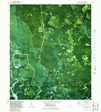
1980 Map of Limehouse
USGS Topo · Published 1987About this map
The Savannah National Wildlife Refuge dominates this 1980s orthophotomap, showing a complex landscape of wetlands and managed waterways along the Georgia-South Carolina border. The map captures a transitional era for Jasper County where traditional rural settlements like Pritchard and Limehouse sit alongside large-scale conservation efforts. Family history and local heritage are well-preserved through numerous named burial sites, including Chisolm Cem, Garret Cem, and New Garret Cem, alongside several community pillars like Mt Olive Ch and Macedonia Ch. The terrain is defined by the heavy presence of water, from the broad Savannah River and Little Back River to the dense Monkey John Swamp. Infrastructure is represented by the Seaboard Coast Line railroad and roads like Cook Landing Road, which provide access to landings and remote facilities such as the Radio Facility.
Find a feature on this map
38 named features on this map. Tap any name to fly to it.
Don’t see what you’re looking for? This feature index may not catch every label — zoom into the map to look around manually.
Map Details
Editions of this 1980 Limehouse Map
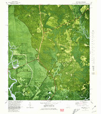
2 editions found
Other maps of this area

1920 · Hardeeville
USGS Topo · 1:62,500

1920 · Okatie
USGS Topo · 1:62,500

1920 · Bluffton
USGS Topo · 1:62,500

1942 · Savannah
USGS Topo · 1:62,500

1942 · Okatie
USGS Topo · 1:62,500

1943 · Hardeeville
USGS Topo · 1:62,500

1945 · Bluffton
USGS Topo · 1:62,500

1947 · Savannah
USGS Topo · 1:250,000

1948 · Savannah
USGS Topo · 1:250,000

1953 · Hardeeville
USGS Topo · 1:62,500