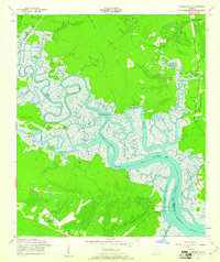
1958 Map of Limerick SE
USGS Topo · Published 1961About this map
Coastal marshlands and tidal waterways define this landscape along the border of Bryan and Liberty Counties, where the Tivoli River and Belfast River converge toward the Atlantic. The settlement of Sunbury sits prominently near the confluence of the Sunbury Channel and East Channel, marking a site of significant early Georgia history near the Fort Morris (Site). Further inland, the Seaboard Air Line railroad traverses the upper reaches of the map, serving timber and naval stores interests near Belfast and Keller. This 1958 field-checked survey highlights the region's reliance on groundwater, evidenced by numerous Artesian Wells dotting the landscape. Cultural landmarks like the George Washington Carver Sch and several country churches, including Bryan Neck Ch and Corinth Ch, provide critical points of interest for genealogists tracing family roots in these coastal communities.
Find a feature on this map
41 named features on this map. Tap any name to fly to it.
Don’t see what you’re looking for? This feature index may not catch every label — zoom into the map to look around manually.
Map Details
Editions of this 1958 Limerick SE Map
2 editions found
Other maps of this area

1920 · Sapelo River
USGS Topo · 1:62,500

1920 · Limerick
USGS Topo · 1:62,500

1928 · St Catherines Island
USGS Topo · 1:62,500
1943 · St Catherines Island
USGS Topo · 1:62,500

1943 · Sapelo River
USGS Topo · 1:62,500

1944 · Limerick
USGS Topo · 1:62,500

1944 · Ossabaw Island
USGS Topo · 1:62,500
1945 · St. Catherine's Island
USGS Topo · 1:62,500

1945 · Ossabaw Island
USGS Topo · 1:62,500

1945 · Sapelo River
USGS Topo · 1:62,500