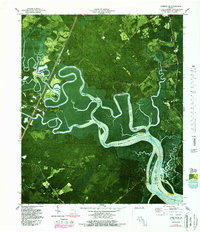
1979 Map of Limerick SE
USGS Topo · Published 1988About this map
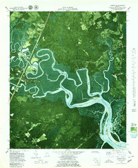
Jerico River and Laurel View River carve a complex network of wetlands and tidal channels through this coastal Georgia landscape, marking the boundary between Bryan and Liberty Counties. The orthophoto base reveals the intricate ecology of Buttermilk Sound and Dutchman Bay, where the Medway River meets the East Channel. Human settlement patterns are tied to the higher ground and the rails of the Seaboard Coast Line, which bypasses the marshy depths of the interior. Historic sites like Old Sunbury and the Isle of Wight anchor the southern reaches, while religious life is centered at Bryan Neck Ch and Corinth Ch. The presence of the Wilkins Cem and other burial grounds suggests long-standing family ties to the land near Belfast, an area defined by its proximity to both the river ways and the Belfast Road.
Find a feature on this map
23 named features on this map. Tap any name to fly to it.
Don’t see what you’re looking for? This feature index may not catch every label — zoom into the map to look around manually.
Map Details
Editions of this 1979 Limerick SE Map
2 editions found
Other maps of this area

1920 · Sapelo River
USGS Topo · 1:62,500

1920 · Limerick
USGS Topo · 1:62,500

1928 · St Catherines Island
USGS Topo · 1:62,500

1943 · St Catherines Island
USGS Topo · 1:62,500

1943 · Sapelo River
USGS Topo · 1:62,500

1944 · Limerick
USGS Topo · 1:62,500

1944 · Ossabaw Island
USGS Topo · 1:62,500

1945 · St. Catherine's Island
USGS Topo · 1:62,500

1945 · Ossabaw Island
USGS Topo · 1:62,500

1945 · Sapelo River
USGS Topo · 1:62,500