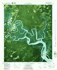
1979 Map of Limerick SE
USGS Topo · Published 1979About this map
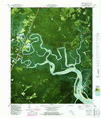
Old Dorchester and New Dorchester sit at the southern edge of this coastal landscape, where the salt marshes of the Medway River meet the pine-dense lowlands of Bryan and Liberty Counties. This 1979 orthophotomap combines aerial photography with topographic data, revealing the intricate drainage patterns of the Laurel View River and Jerico River as they wind through Buttermilk Sound. The settlement of Belfast is situated along the Seaboard Coast Line railroad, connected to the hinterland by Belfast Road. Genealogists may find value in the location of Corinth Ch Cem and Wilkins Cem, while historians can locate the Fort Morris (Site) near the Dutchman Bay shoreline. The presence of several boat ramps and a pumping station along the riverbanks highlights the ongoing relationship between the local economy and these tidal waterways.
Find a feature on this map
28 named features on this map. Tap any name to fly to it.
Don’t see what you’re looking for? This feature index may not catch every label — zoom into the map to look around manually.
Map Details
Editions of this 1979 Limerick SE Map
2 editions found
Other maps of this area

1920 · Sapelo River
USGS Topo · 1:62,500

1920 · Limerick
USGS Topo · 1:62,500

1928 · St Catherines Island
USGS Topo · 1:62,500

1943 · St Catherines Island
USGS Topo · 1:62,500

1943 · Sapelo River
USGS Topo · 1:62,500

1944 · Limerick
USGS Topo · 1:62,500

1944 · Ossabaw Island
USGS Topo · 1:62,500

1945 · St. Catherine's Island
USGS Topo · 1:62,500

1945 · Ossabaw Island
USGS Topo · 1:62,500

1945 · Sapelo River
USGS Topo · 1:62,500