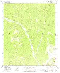
1977 Map of Limestone Canyon South
USGS Topo · Published 1978About this map
Fort Apache Indian Reservation encompasses this high-plateau landscape, where the convergence of several deep drainages creates a complex network of canyons and ridges. The confluence of Cibecue Creek and Carrizo Creek serves as a central geographical anchor, with the terrain rising sharply toward Cibecue Ridge to the west and Limestone Ridge to the east. This 1970s revision, based on earlier Bureau of Indian Affairs fieldwork, shows the essential water infrastructure required for land management in this environment, including Limestone Ridge Tank No 2 and Cedar Mesa Tanks. Evidence of human passage and activity is recorded through a remote Landing Strip, a lonely Grave, and several named water sources like Blue Spring and the descriptively named Rotten Spring. These features, along with numerous unnamed jeep trails, reveal the logistical patterns of range management and travel within the reservation during this era.
Find a feature on this map
23 named features on this map. Tap any name to fly to it.
Don’t see what you’re looking for? This feature index may not catch every label — zoom into the map to look around manually.
Map Details
Editions of this 1977 Limestone Canyon South Map
This is the sole edition of this map. No revisions or reprints were ever made.
Other maps of this area

1886 · Holbrook
USGS Topo · 1:250,000

1893 · Holbrook
USGS Topo · 1:250,000

1954 · Holbrook
USGS Topo · 1:250,000

1954 · Mesa
USGS Topo · 1:250,000

1957 · Mesa
USGS Topo · 1:250,000

1957 · Holbrook
USGS Topo · 1:250,000

1958 · Mesa
USGS Topo · 1:250,000

1958 · Holbrook
USGS Topo · 1:250,000

1960 · Holbrook
USGS Topo · 1:250,000

1960 · Mesa
USGS Topo · 1:250,000