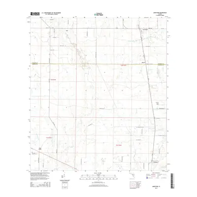
2015 Map of Limestone
USGS Topo · Published 2015About this map
Pine Level and Lily anchor a landscape defined by cattle ranching and orange groves along the border of Hardee and DeSoto counties. This 2015 survey reveals a rural network of family-named roads like Phil Roberts Rd and Raymond Davis Rd that navigate the wetlands surrounding Horse Cr. The area’s history is preserved at the Pine Level Campground Cem and the Lamp Grounds Cem near Lansing, marking the persistence of early settlement patterns in the Florida interior. Near the southeastern corner, the Peace River flows toward the coast, while the Frierson Grove Airport provides a modern logistical link for the local citrus industry. The map illustrates the hydrological complexity of the region, where numerous named branches such as Brandy Br and Buzzard Roost Br feed into the larger creek systems.
Find a feature on this map
55 named features on this map. Tap any name to fly to it.
Don’t see what you’re looking for? This feature index may not catch every label — zoom into the map to look around manually.
Map Details
Editions of this 2015 Limestone Map
This is the sole edition of this map. No revisions or reprints were ever made.
Other maps of this area

1956 · Gardner
USGS Topo · 1:24,000

1956 · Ona
USGS Topo · 1:24,000

1956 · Edgeville
USGS Topo · 1:24,000

1956 · Murdock NE
USGS Topo · 1:24,000

1956 · Myakka Head
USGS Topo · 1:24,000

1956 · Limestone
USGS Topo · 1:24,000

1956 · Zolfo Springs
USGS Topo · 1:24,000

1956 · Nocatee
USGS Topo · 1:24,000

1956 · Tampa
USGS Topo · 1:250,000

1956 · Fort Pierce
USGS Topo · 1:250,000