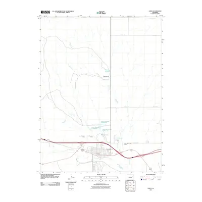
2010 Map of Limon
USGS Topo · Published 2010About this map
The town of Limon serves as the focal point of this high-plains landscape, where the confluence of modern transportation and early 21st-century water management is clearly visible. The settlement is positioned near the junction of Big Sandy Creek and Lake Creek, a critical hydrology network in an arid region. The map details an extensive series of water controls, including the Limon Watershed L-3 Reservoir, Limon Watershed L-2 Reservoir, and the Lake Creek Reservoir. These reservoirs, managed by structures like the Limon Watershed L-3 Dam and Lake Creek Dam, illustrate the community's reliance on captured surface water.
Find a feature on this map
19 named features on this map. Tap any name to fly to it.
Don’t see what you’re looking for? This feature index may not catch every label — zoom into the map to look around manually.
Map Details
Editions of this 2010 Limon Map
This is the sole edition of this map. No revisions or reprints were ever made.
Other maps of this area

1891 · Limon
USGS Topo · 1:125,000

1892 · Limon
USGS Topo · 1:125,000

1954 · Limon
USGS Topo · 1:250,000

1957 · Limon
USGS Topo · 1:250,000

1958 · Limon
USGS Topo · 1:250,000

1970 · Limon
USGS Topo · 1:24,000

1970 · Four Corners
USGS Topo · 1:24,000
1970 · Barking Dog Spring
USGS Topo · 1:24,000
1970 · Matheson NE
USGS Topo · 1:24,000

1970 · T Draw
USGS Topo · 1:24,000