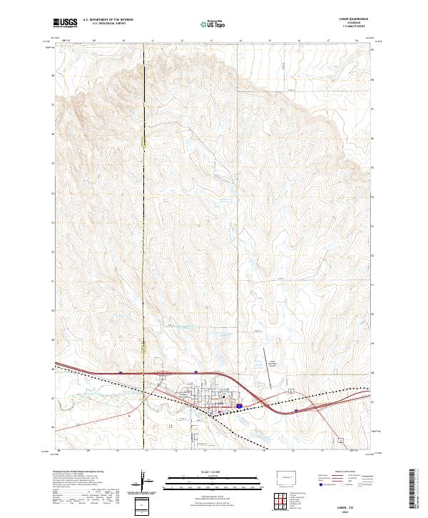
2022 Map of Limon
USGS Topo · Published 2022About this map
Limon serves as a vital High Plains crossroads where the Elbert Co and Lincoln Co line meets the drainage of Big Sandy Creek. This modern survey illustrates the town's role as a regional hub, featuring the Morgan Community College Limon Center and the Limon Municipal Airport. The landscape is defined by a sophisticated water management system designed for this semi-arid environment, including the Limon Watershed L-2 Reservoir, Limon Watershed L-3 Reservoir, and Nienhuser Reservoir. These catchments, along with Lake Cr Reservoir, follow the natural contours of the drainages feeding into Big Sandy Cr. Local history is anchored at the Pershing Memorial Cem near the town center, while a grid of county roads like Co RD 3n and Co RD 23 connects the surrounding agricultural sections.
Find a feature on this map
34 named features on this map. Tap any name to fly to it.
Don’t see what you’re looking for? This feature index may not catch every label — zoom into the map to look around manually.
Map Details
Editions of this 2022 Limon Map
This is the sole edition of this map. No revisions or reprints were ever made.
Other maps of this area

1891 · Limon
USGS Topo · 1:125,000

1892 · Limon
USGS Topo · 1:125,000

1954 · Limon
USGS Topo · 1:250,000

1957 · Limon
USGS Topo · 1:250,000

1958 · Limon
USGS Topo · 1:250,000

1970 · Limon
USGS Topo · 1:24,000

1970 · Four Corners
USGS Topo · 1:24,000
1970 · Barking Dog Spring
USGS Topo · 1:24,000
1970 · Matheson NE
USGS Topo · 1:24,000

1970 · T Draw
USGS Topo · 1:24,000