
1958 Map of Limon
USGS Topo · Published 1958About this map
The High Plains of eastern Colorado and the Kansas borderlands are defined here by a network of drainage basins and vital rail corridors during the late 1950s. The Chicago Rock Island and Pacific railroad bisects the landscape, serving agricultural settlements like Limon, Flagler, and Burlington. To the north, the Union Pacific line parallels the northern frontier, connecting smaller outposts such as Harrisburg and Vernon. Water management is central to the region's character, anchored by the Bonny Reservoir and Bonny Dam on the South Fork Republican River. The terrain is marked by the distinct Sand Hills and a series of intermittent river systems, including the Arikaree River and the North Fork Smoky Hill River. Sparse Oil wells appear in the northern reaches, signaling the industrial activity present alongside traditional ranching and rail-based commerce.
Find a feature on this map
53 named features on this map. Tap any name to fly to it.
Don’t see what you’re looking for? This feature index may not catch every label — zoom into the map to look around manually.
Map Details
Editions of this 1958 Limon Map
This is the sole edition of this map. No revisions or reprints were ever made.
Other maps of this area

1889 · Sanborn
USGS Topo · 1:125,000

1891 · Sanborn
USGS Topo · 1:125,000

1891 · Arroyo
USGS Topo · 1:125,000

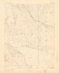
1891 · Kit Carson
USGS Topo · 1:125,000

1891 · Limon
USGS Topo · 1:125,000

1892 · Limon
USGS Topo · 1:125,000

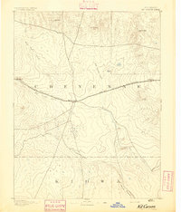
1892 · Cheyenne Wells
USGS Topo · 1:125,000
1893 · Arroyo
USGS Topo · 1:125,000
1893 · Kit Carson
USGS Topo · 1:125,000

1893 · Sanborn
USGS Topo · 1:125,000