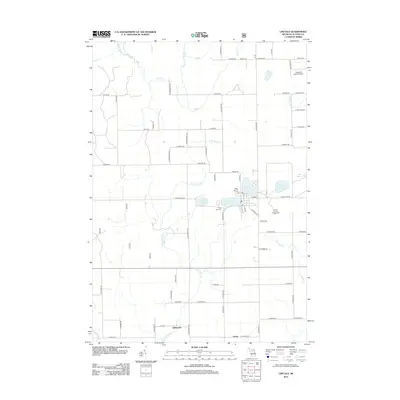
2012 Map of Lincoln
USGS Topo · Published 2012About this map
Lincoln Lake and its neighboring waters form the center of this northeastern Michigan landscape, where the village of Lincoln serves as a focal point for the surrounding township. The map details a transition from the structured street grid near the Alcona County Fairgrounds to the more dispersed rural reaches of Gustin and Killmaster. Water dominates the geography, with the E Br Pine River and numerous tributaries like Sucker Cr and Fish Cr winding through the terrain. Evidence of community life is found in landmarks such as the Twin Lake Cem and the Flying M Ranch Airport to the north. The area's character is defined by its glacial lakes—including Crystal Lake, Brownlee Lake, and Trask Lake—which are interconnected by a network of rural roads such as Miller Rd and Ritchie Rd.
Find a feature on this map
74 named features on this map. Tap any name to fly to it.
Don’t see what you’re looking for? This feature index may not catch every label — zoom into the map to look around manually.
Map Details
Editions of this 2012 Lincoln Map
This is the sole edition of this map. No revisions or reprints were ever made.
Other maps of this area

1954 · Tawas City
USGS Topo · 1:250,000

1958 · Tawas City
USGS Topo · 1:250,000

1959 · Glennie
USGS Topo · 1:62,500

1959 · Harrisville
USGS Topo · 1:62,500

1971 · Spruce
USGS Topo · 1:24,000
1971 · Black River
USGS Topo · 1:24,000

1972 · Hubbard Lake
USGS Topo · 1:24,000

1983 · Hubbard Lake
USGS Topo · 1:100,000
1989 · Harrisville
USGS Topo · 1:24,000
1989 · Barton City
USGS Topo · 1:24,000