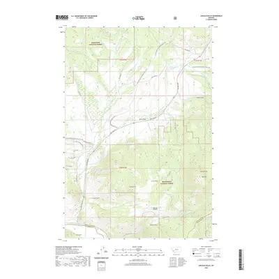
2020 Map of Lincoln Gulch
USGS Topo · Published 2020About this map
Lincoln Gulch and French Gulch define the historical mining landscape of this high-elevation terrain near the crest of the Rockies. Positioned along the divide between Deerlodge National Forest and Beaverhead National Forest, the region is marked by a complex network of drainage basins including Moose Creek and Panama Creek. The rugged topography is bisected by the Continental Divide National Scenic Trail, which winds through the northern and central sections of the map. In the south, the Big Hole River flows along the border of Deer Lodge and Beaverhead Counties, while several family-named landmarks like Connor Gulch, Still Gulch, and Johnson Gulch suggest a history of prospecting and homesteading. High alpine features such as Bear Mtn and Mariah Meadows overlook the deeply carved gulches that once drew industry to these remote mountain drainages.
Find a feature on this map
47 named features on this map. Tap any name to fly to it.
Don’t see what you’re looking for? This feature index may not catch every label — zoom into the map to look around manually.
Map Details
Editions of this 2020 Lincoln Gulch Map
This is the sole edition of this map. No revisions or reprints were ever made.
Other maps of this area

1889 · Helena
USGS Topo · 1:250,000

1893 · Helena
USGS Topo · 1:250,000

1893 · Dillon
USGS Topo · 1:250,000

1899 · Helena
USGS Topo · 1:250,000

1903 · Helena
USGS Topo · 1:250,000

1908 · Philipsburg
USGS Topo · 1:125,000

1947 · Butte
USGS Topo · 1:250,000

1955 · Dillon
USGS Topo · 1:250,000

1957 · Dillon
USGS Topo · 1:250,000

1958 · Butte
USGS Topo · 1:250,000