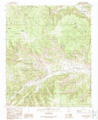
1989 Map of Lincoln
USGS Topo · Published 1989About this map
The Lincoln settlement and the winding valleys of the Rio Bonito define this high-altitude landscape in the late 1980s. This territory is heavily divided by the Lincoln National Forest and the U.S. Government Reservation Boundary, showing a complex mix of public and private land use. The map highlights the essential water infrastructure of the region, including livestock-oriented features like Reds Tank and Ramey Tank, which were critical for ranching in the arid terrain.
Find a feature on this map
39 named features on this map. Tap any name to fly to it.
Don’t see what you’re looking for? This feature index may not catch every label — zoom into the map to look around manually.
Map Details
Editions of this 1989 Lincoln Map
This is the sole edition of this map. No revisions or reprints were ever made.
Other maps of this area

1934 · Capitan
USGS Topo · 1:48,000

1935 · Capitan Mountains
USGS Topo · 1:48,000

1937 · Capitan
USGS Topo · 1:62,500

1940 · Capitan Mountains
USGS Topo · 1:62,500

1955 · Roswell
USGS Topo · 1:250,000

1958 · Roswell
USGS Topo · 1:250,000

1961 · Lincoln
USGS Topo · 1:62,500

1962 · Roswell
USGS Topo · 1:250,000

1963 · Fort Stanton
USGS Topo · 1:24,000

1963 · Ruidoso Downs
USGS Topo · 1:24,000