
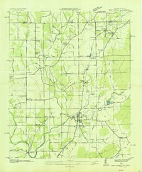
1936 Map of Lincoln
USGS Topo · Published 1936About this map
The Elk River winds through the northern portion of this Lincoln County landscape, creating prominent geographic bends like Morgan Bend and Henry Bend. This 1936 survey reveals a rural Tennessee community defined by small settlements and family landmarks during the early years of the Tennessee Valley Authority’s regional infrastructure expansion. A network of early state roads, including State Highway No 10 and State Highway No 110, connects the town of Lincoln with outlying hamlets such as Skinem and Prospect.
Find a feature on this map
57 named features on this map. Tap any name to fly to it.
Don’t see what you’re looking for? This feature index may not catch every label — zoom into the map to look around manually.
Map Details
Editions of this 1936 Lincoln Map
This is the sole edition of this map. No revisions or reprints were ever made.
Other maps of this area

1888 · Scottsboro
USGS Topo · 1:125,000

1888 · Huntsville
USGS Topo · 1:125,000

1892 · Huntsville
USGS Topo · 1:125,000

1892 · Scottsboro
USGS Topo · 1:125,000

1936 · Flintville
USGS Topo · 1:24,000

1936 · Taft
USGS Topo · 1:24,000

1936 · Fisk
USGS Topo · 1:24,000

1936 · Boonshill
USGS Topo · 1:24,000

1936 · Toney
USGS Topo · 1:24,000
1936 · New Market
USGS Topo · 1:24,000