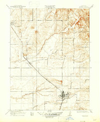
1910 Map of Lincoln
USGS Topo · Published 1947About this map
The town of Lincoln serves as the primary hub in this early 20th-century survey of western Placer County. As a critical point for the Southern Pacific R R, the area’s development is tied closely to the transport of local resources, highlighted by a prominent Quarry and the Marysville Line branching through the landscape. The map captures the agricultural and industrial layout of the era, from the established settlement of Sheridan in the northwest to the rural Fairoaks School and the small siding at Ewing. Natural watercourses including Coon Creek, Doty Creek, and Auburn Ravine segment the terrain, while local genealogy is grounded by the presence of a Cem near the town center. This record illustrates the transition from raw ranchland to a railroad-connected industrial landscape before the mid-century expansion of Northern California.
Find a feature on this map
13 named features on this map. Tap any name to fly to it.
Don’t see what you’re looking for? This feature index may not catch every label — zoom into the map to look around manually.
Map Details
Editions of this 1910 Lincoln Map
2 editions found
Other maps of this area

1888 · Smartsville
USGS Topo · 1:125,000

1891 · Sacramento
USGS Topo · 1:125,000

1891 · Smartsville
USGS Topo · 1:125,000

1892 · Sacramento
USGS Topo · 1:125,000

1892 · Smartsville
USGS Topo · 1:125,000

1893 · Sacramento
USGS Topo · 1:125,000

1894 · Smartsville
USGS Topo · 1:125,000

1895 · Smartsville
USGS Topo · 1:125,000

1910 · Sheridan
USGS Topo · 1:31,680

1910 · Lincoln
USGS Topo · 1:31,680