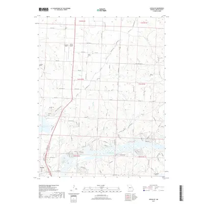
2017 Map of Lincoln SE
USGS Topo · Published 2017About this map
The Harry S Truman Reservoir and the Lake of the Ozarks define the southern landscape of this Missouri quadrangle, where the Osage River valley was transformed by mid-century engineering. Just north of Warsaw, the terrain is etched with numerous family and community landmarks, including Mount Pleasant Cem, Vincent Cem, and Bird Cem, providing a clear record of local settlement patterns. The map detail highlights a transitional landscape where aviation at the Warsaw Municipal Airport meets the older topography of named drainages like Duran Cr and Negro Cr. Deeply incised valleys such as Sweatman Hollow and Townes Hollow run toward the water's edge, reflecting the complex drainage system of Benton County before and after the creation of the massive reservoirs.
Find a feature on this map
108 named features on this map. Tap any name to fly to it.
Don’t see what you’re looking for? This feature index may not catch every label — zoom into the map to look around manually.
Map Details
Editions of this 2017 Lincoln SE Map
This is the sole edition of this map. No revisions or reprints were ever made.
Other maps of this area

1887 · Warsaw
USGS Topo · 1:125,000

1894 · Warsaw
USGS Topo · 1:125,000

1935 · Edwards
USGS Topo · 1:24,000

1935 · Dell
USGS Topo · 1:24,000

1936 · Shawnee Bend
USGS Topo · 1:24,000

1936 · Lakeview Heights
USGS Topo · 1:24,000

1936 · Schuyler
USGS Topo · 1:24,000

1945 · Fristoe
USGS Topo · 1:62,500

1947 · Jefferson City
USGS Topo · 1:250,000

1954 · Jefferson City
USGS Topo · 1:250,000