1989 Map of Lincolnville SW
USGS Topo · Published 1990About this map
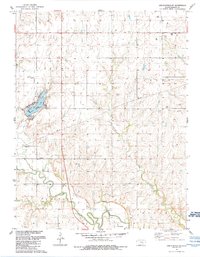
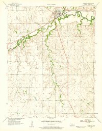
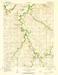
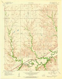
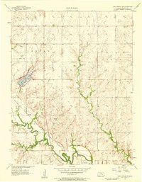
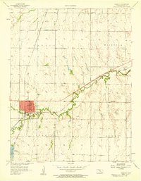
The Cottonwood River meanders across the southern landscape of this Marion County region, marking a transition from the agricultural uplands to the river bottomlands. Centered on the town of Florence, the map illustrates a developed local infrastructure characterized by multiple Oil Wells and a network of pipelines that reflect the area's energy industry. To the northwest, Marion County Lake serves as a significant geographical focal point, featuring a trailer park, boat ramp, and a prominent spillway.
Find a feature on this map
24 named features on this map. Tap any name to fly to it.
Don’t see what you’re looking for? This feature index may not catch every label — zoom into the map to look around manually.
Map Details
Editions of this 1989 Lincolnville SW Map
This is the sole edition of this map. No revisions or reprints were ever made.
Other maps of this area

1889 · Newton
USGS Topo · 1:125,000

1894 · Newton
USGS Topo · 1:125,000

1898 · Cottonwood Falls
USGS Topo · 1:125,000

1955 · Hutchinson
USGS Topo · 1:250,000
1957 · Florence
USGS Topo · 1:24,000
1957 · Wonsevu
USGS Topo · 1:24,000
1957 · Cedar Point
USGS Topo · 1:24,000
1957 · Lincolnville SW
USGS Topo · 1:24,000
1957 · Peabody
USGS Topo · 1:24,000

1959 · Hutchinson
USGS Topo · 1:250,000